
News
When Professors Speak Out, Some Students Stay Quiet. Can Harvard Keep Everyone Talking?

News
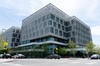
Allston Residents, Elected Officials Ask for More Benefits from Harvard’s 10-Year Plan
News
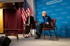
Nobel Laureate Claudia Goldin Warns of Federal Data Misuse at IOP Forum

News
Woman Rescued from Freezing Charles River, Transported to Hospital with Serious Injuries
News
Harvard Researchers Develop New Technology to Map Neural Connections
New Geological Collection.
The Geological Department has just received from Chicago several sets of maps, charts, photographs and models on geological subjects, that were exhibited in different parts of the World's Fair. These collections which have been made through the efforts of members of the Geological Department, will make a valuable addition to the present collection.
By are the most valuable set is a series of maps and models comprising part of the exhibit of the geographical service of the French army. One of the models was the best of its kind exhibited at the fair. It is of a review used by the officers of the French army for the study of military evolutions. While Harvard has had to share part of the exhibit with the U. S. Coast Survey, she is fortunate in getting this model, as it is the only one possessed by a non-military institution.
Another valuable collection is a set of photographs given by the commissioner of North Dakota, illustrating the plains of the Red River of the North. There are also a set of views in Ontario, given by the commissioner of Ontario; views in Nova Scotia, including the regions of the Bay of Funday, from the Nova Scotia Railway; and a set covering the regions of Virginia from the Norfolk and Western R. R.
Want to keep up with breaking news? Subscribe to our email newsletter.